Mawenzi Peak Kilimanjaro
Mawenzi Peak is the second-highest point on Mount Kilimanjaro, reaching 5,149 meters (16,893 feet). While Kibo, home to Uhuru Peak, attracts thousands of climbers each year, Mawenzi is reserved for experienced mountaineers due to its technical difficulty.
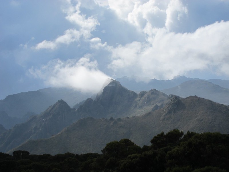
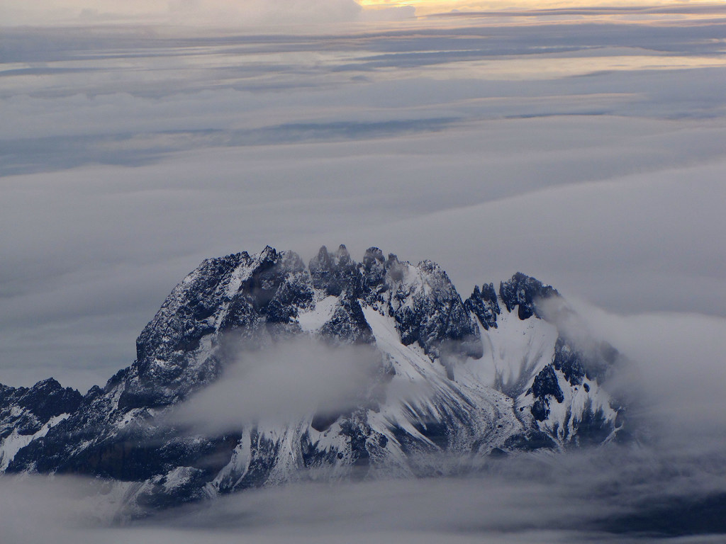
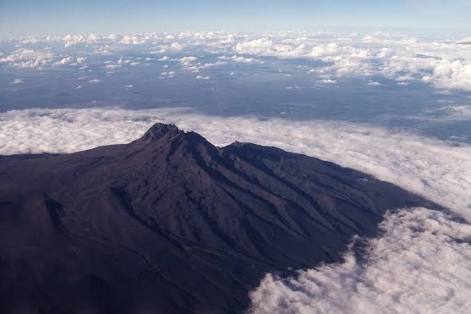
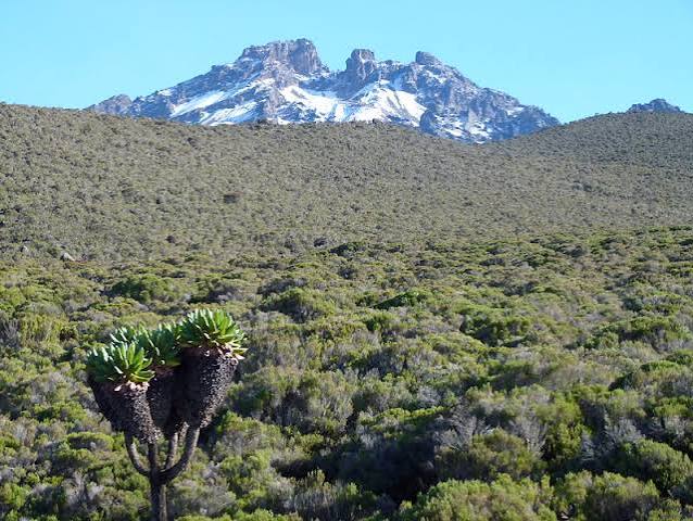
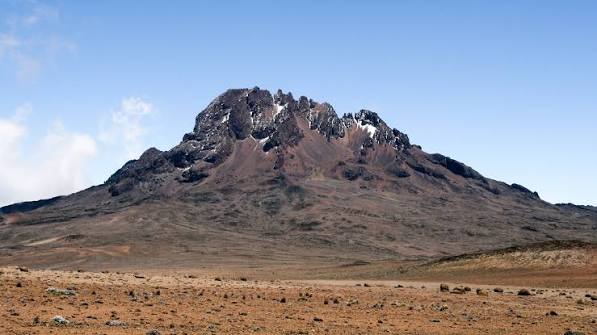
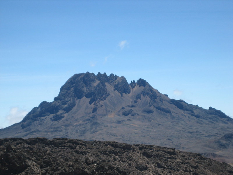
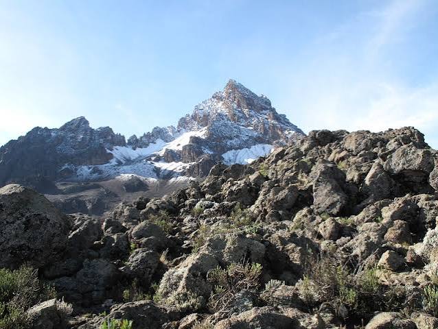
Its jagged silhouette, shaped by hardened volcanic rock, is one of East Africa’s most recognizable landmarks and offers exceptional views.
Mawenzi is Africa’s third-highest summit, after Kibo (5,895 meters) and Mount Kenya (5,199 meters). Although its ranking was once debated, accurate measurements confirm Mawenzi stands just 50 meters (164 feet) below Mount Kenya.
Unlike Kibo, which offers non-technical routes accessible to fit trekkers, Mawenzi presents a serious mountaineering challenge. Its steep slopes, loose rocks, and technical climbing requirements mean that only skilled climbers with appropriate equipment should attempt its summit.
Due to its challenging terrain, the peak remains less well-known than Kibo Peak, as most climbers choose the more accessible routes to Uhuru Peak. Those who climb Mawenzi experience a raw and untamed ascent, which is now uncommon among popular mountains.
Location of Mawenzi Peak
Geographic Position
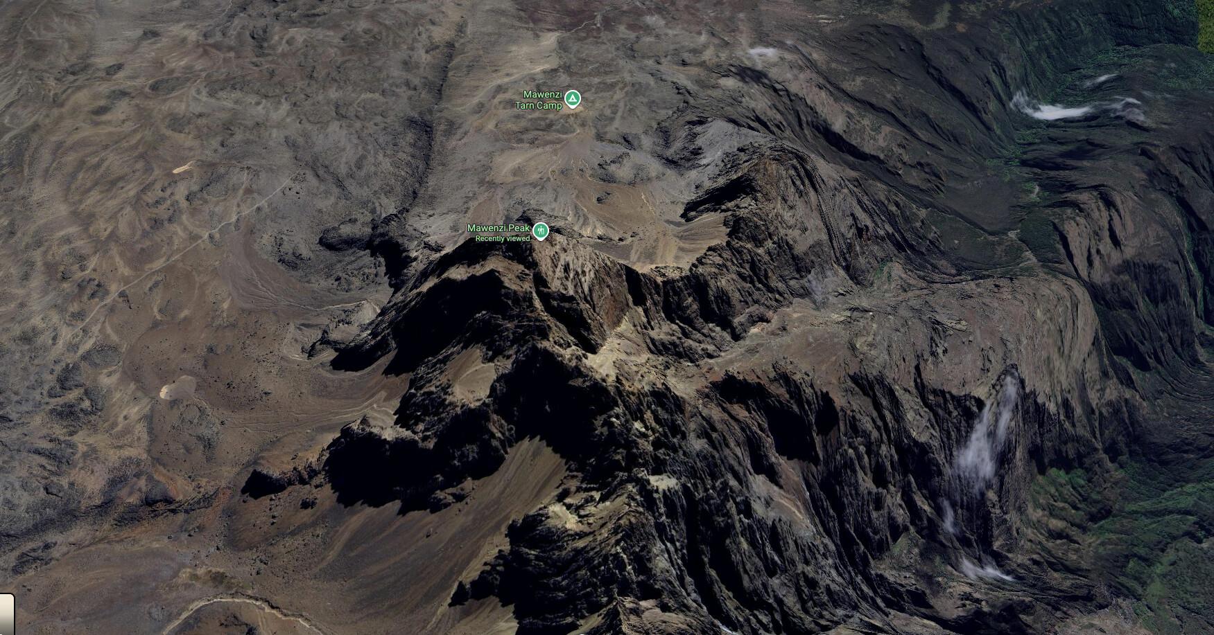
Mawenzi Peak lies on the eastern side of Mount Kilimanjaro, about 11 kilometers (7 miles) from Kibo Peak. The two peaks are linked by the Saddle, a high-altitude plain at roughly 4,500 meters that separates the volcanic cones. Climbers cross the Saddle on several routes, including Rongai and Marangu, which provide impressive views of both peaks.
Mawenzi Peak Map
Relationship to Kibo and Shira
Mount Kilimanjaro consists of three volcanic cones:
- Kibo Peak (5,895 meters): The highest cone, home to Uhuru Peak
- Mawenzi Peak (5,149 meters): The second-highest cone, known for its jagged profile
- Shira Peak (3,962 meters): The oldest and lowest cone, now forming a plateau
Views and Perspectives
- From Mawenzi, climbers have exceptional views of:
- Kibo Peak: Kilimanjaro’s highest point, rising above the saddle
- Shira Plateau: The ancient caldera to the west
- The Saddle: The high-altitude plain connecting the peaks
- The plains below: Panoramic views across Tanzania and into Kenya
What is Mawenzi Peak Unique for?
Jagged and Spiky Profile
Mawenzi is easily identified by its jagged, spiky summit. In contrast to Kibo’s smooth, dome-like shape, Mawenzi displays sharp ridges, steep faces, and dramatic pinnacles, resembling a shattered crown. This form results from its volcanic origins and significant erosion.
Hardened Lava
The peak consists of hardened volcanic rock that has weathered over millennia, giving it a jagged appearance. Broken rock, steep inclines, and loose material make climbing difficult and require careful route selection and technical expertise.
Mawenzi Peaks
Mawenzi features numerous named peaks and pinnacles, each with its own character:
- Nordecke (5,136 meters): The northernmost peak
- Hans Meyer Peak (5,149 meters): The highest point
- Purtscheller Peak (5,120 meters): Named after the Austrian mountaineer who made the first ascent of Kibo
- Borchers Peak (5,115 meters): Another prominent summit
- Klute Peak (5,096 meters): Named after one of the early explorers
- Latham Peak (5,087 meters): A notable pinnacle
- Londt South Peak (4,945 meters): With its north pinnacles
The History of Mawenzi Peak
First Ascent
Oehler and F. Klute made the first ascent of Mawenzi on July 29, 1912, reaching its highest point via the Oehler Couloir. This route remains a technical option for climbers. Their achievement established Mawenzi as a prominent objective in African mountaineering.
Naming of Hans Meyer Peak
Mawenzi’s main summit, Point Hans Meyer, is named for German geologist Hans Meyer, who completed the first documented ascent of Kibo in 1889 with Ludwig Purtscheller and local guide Mzee Johannes Kinyala Lauwo. His contributions to the exploration of Kilimanjaro are recognized in several mountain features, including Hans Meyer Cave on the Marangu Route.
Closure and Reopening
Mawenzi was closed to climbers for many years due to hazardous conditions, including steep terrain and unstable rock, which led to past fatalities. The area has recently reopened to experienced mountaineers, but it remains dangerous and requires thorough planning and caution.
Can You Climb Mawenzi Peak?
Technical Difficulty
Climbing Mawenzi Peak is possible, but it involves significant technical challenges:
- Steep slopes that require precise footwork
- Loose rocks and unstable terrain
- Exposed sections with significant drop-offs
- Technical climbing, including scrambling and possible rope work
Permits and Requirements
Climbers must meet the following requirements to be allowed to climb Mawenzi Peak
- Submit permit applications at least one month in advance
- Provide a detailed list of technical mountaineering equipment
- Arrange for a knowledgeable guide well in advance
- Pay an additional US$750 on top of regular park fees
Safety Concerns
Kilimanjaro National Park authorities are working to establish a safer route to Mawenzi Peak. Although climbing is permitted, significant risks remain, and fatalities have occurred. Few tour operators offer climbs to Mawenzi, as most prioritize the safer Kibo routes. Anyone attempting Mawenzi should proceed with extreme caution.
Routes to Mawenzi Peak
Starting Points
Climbers may begin their ascent of Mawenzi from one of the following locations:
- Mawenzi Hut (4,600 meters): Situated below the west face and near a water source.
- Mawenzi Tarn Huts: An alternative starting point on the mountain.
Approach Routes
The starting point camps can be accessed by the following routes:
- Marangu Route: Accessed via Marangu Gate, passing Mandara Huts and Horombo Huts.
- Rongai Route: Approached through the Rombo District to Loitokitok and Rongai Gate.
- From Kibo Hut: Available after ascending Kibo.
The Oehler Couloir Route
The most straightforward route to the main summit is via the Oehler Couloir at mid-height. This route includes the following sections:
- North-West Corrie: Begin in the upper left corner of the scree.
- Oehler Couloir: A steep gully that leads to the ridge.
- Col above: Reached after ascending the couloir.
- Hans Meyer Peak: Located a short distance to the south.
Route Details:
- Duration: 5 hours
- Grade: 400m II*
- Start: From the northwestern corrie, between two gullies on the left side.
Challenges on the Route
Climbers should be prepared for the following challenges:
- Rock collapse: Melting snow can cause rocks to fall.
- Ice sections: Insufficient snow cover may expose ice and rocks.
- Route finding: The path may be difficult to follow in poor conditions.
Geography of Mawenzi
Ridges
Mawenzi is characterized by several prominent ridges that shape its distinctive profile.
- From Nordecke, the Northeast Ridge, North Spur, and Northwest Ridge extend outward.
- From Hans Meyer Peak, the Oehler Buttress extends to the west.
- From Purtscheller Peak, the West Ridge extends.
- From Klute Peak, the Middle Buttress extends eastward.
- From Londt Peak, the Southwest Ridge, Londt’s Ridge, South Ridge, Southeast Ridge, and East Ridge radiate outward.
Faces and Gullies
The peak’s faces and gullies include:
In the West:
- Oehler Gully between North West Ridge and Oehler Buttress
- North West Corrie between Oehler Buttress and West Ridge
- West Corrie between West and South West Ridges
- South West Corrie between South West and Londt’s Ridges
- South Corrie between Londt’s and South Ridges
In the East:
- Little Barranco between North East Ridge and Middle Buttress
- Great Barranco between Middle Buttress and East Ridge
In the North:
- North Corrie between the North Ridges
Best Time to Climb Mawenzi
Optimal Conditions
The best time to climb Mawenzi is during the warm and dry months:
- January to March: Warm and dry conditions with stable weather
- June to October: The main dry season with clear skies
These periods offer the most favorable conditions for the challenging climb, reducing the risk of snow and rockfall.
Months to Avoid
Climbers should avoid:
- March to May: Heavy rains create dangerous conditions
- November to early January: Short rainy season with unstable conditions
How to Get to Mawenzi Peak
Starting Town
The starting point for both the Marangu and Rongai routes is the town of Moshi, located at the foot of Mount Kilimanjaro.
Nearest Airports
The most convenient airports for reaching Mawenzi are:
- Kilimanjaro International Airport: Located between Moshi and Arusha
- Jomo Kenyatta International Airport: In Nairobi, Kenya
- Julius Nyerere International Airport: In Dar es Salaam, Tanzania
Marangu Route to Mawenzi
- Moshi → Marangu → Marangu Gate → Mandara Huts → Horombo Huts → Mawenzi Huts
Rongai Route to Mawenzi
- Moshi → Marangu → Rombo District → Loitokitok (near Kenyan border) → Rongai → First Cave Camp → Second Cave Camp → Mawenzi Tarn Huts or Mawenzi Hut
Frequently Asked Questions About Mawenzi Peak
What Is Mawenzi Peak?
Mawenzi Peak, at 5,149 meters (16,893 feet) above sea level, is the second-highest peak on Mount Kilimanjaro and the third-highest in Africa, after Kibo (5,895 meters) and Mount Kenya (5,199 meters). Its profile is defined by dramatic, jagged spires.
Where Is Mawenzi Peak Located?
Mawenzi Peak lies on the eastern side of Mount Kilimanjaro, about 11 kilometers (7 miles) from Kibo Peak. The two are connected by the Saddle, a high-altitude plain at 4,500 meters.
Can I Climb Mawenzi Peak?
Climbing is possible but extremely challenging, requiring technical skills, specialized equipment, and advanced mountaineering experience. Permits must be obtained at least one month in advance, with an additional US$750 fee on top of regular park charges. Few, if any, tour operators offer climbing services to Mawenzi.
What Is the Elevation of Mawenzi Peak?
Mawenzi Peak, at 5,149 meters (16,893 feet), is the second-highest point on Mount Kilimanjaro and the third-highest peak in Africa.
What Are the Main Summits on Mawenzi?
The main summits are Nordecke (5,136m), Hans Meyer Peak (5,149m), Purtscheller Peak (5,120m), Borchers Peak (5,115m), Klute Peak (5,096m), Latham Peak (5,087m), and Londt South Peak (4,945m), with Hans Meyer Peak as the highest.
Why Is Mawenzi So Challenging?
Mawenzi is challenging due to its steep slopes, loose rocks, technical climbing sections, and exposed terrain. The volcanic rock is broken and unstable, making route-finding and movement difficult. Climbers must be highly skilled and use specialized equipment.
What Is the Oehler Couloir Route?
The Oehler Couloir route is the simplest way to ascend Mawenzi’s main summit. It takes approximately 5 hours and is rated 400m II*. The route follows a steep gully and requires navigation through scree, gullies, and sections of ice or rock.
When Is the Best Time to Climb Mawenzi?
The best time to climb Mawenzi is during the warm and dry months of January to March and June to October. Climbers should avoid the rainy seasons from March to May and November to early January.
Is Mawenzi Dangerous?
Mawenzi has previously been closed due to fatalities and continues to pose significant hazards. The terrain is steep and unstable, with rocks that may collapse. Climbers should exercise extreme caution and be fully prepared for these risks.
What Equipment Is Required for Mawenzi?
Technical mountaineering equipment is required, such as ropes, crampons, ice axes, harnesses, and helmets. Please submit a detailed equipment list to the park authorities with your permit application. Some specialized gear may need to be imported.
What Is the History of Mawenzi?
Mawenzi was first climbed on July 29, 1912, by E. Oehler and F. Klute. Its highest summit, Hans Meyer Peak, is named for the German geologist who first ascended Kibo in 1889. Mawenzi was closed for many years due to fatalities but has recently reopened under strict safety regulations.
How Does Mawenzi Compare to Kibo?
Kibo, the highest peak in Africa, can be climbed without technical equipment. In contrast, Mawenzi, the third-highest, requires advanced mountaineering skills. Mawenzi’s jagged profile differs sharply from Kibo’s smooth, dome-like shape.
Plan Your Mawenzi Peak Adventure
Mawenzi Peak is among Africa’s most challenging and rewarding climbs. Its dramatic shape, technical routes, and stunning views attract experienced climbers seeking true adventure.
Our expert team can advise on Mawenzi logistics, including permit applications and equipment requirements. For those prioritizing safety, we also offer guided Kibo climbs and other Kilimanjaro expeditions.
If you would like to discuss your Kilimanjaro expedition or learn more about the mountain, please get in touch with us. BOOK YOUR CLMB NOW
Mawenzi Peak Photos
You May Also Like